Discovery of Ratlam | Mysahar.in

About Ratlam Madhya Pradesh.
Ratlam is a well-known city located in Madhya Pradesh, which is known all over the state for many types of huge industries, its jewelry, crops, Ratlami sarees, pilgrimage sites, and special types of dishes made here. There are more than fifty-one big and small industries located here, some of which include Electrical Copper Wire Manufacturing, Oxygen & Industrial Gases Producing Plants, Grain, Cotton, Foods Processing Plants, Steel Plants, and Drug Manufacturing Plants. In ancient times, the city was known for the export of opium, hemp, tobacco, and salt. Nowadays, silk, opium, wheat, cotton, maize, soybean, sugarcane, and gram crops are mainly grown here.
It is also known for its historical pilgrimage sites, in which Kalika Mata Temple, Barbad Hanuman Temple, Mahalakshmi Mata Temple, Shri Nageshwar Parshwanath Tirtha, etc prominent places. Famous dishes here include Dum Biryani, Kulfi Faluda, Ratlami Sev, Kachori Chaat, Ratlami Thali, Palak Chaat, Special Chai, and Banana Samosa.
This city was built at the time of India’s independence in the year 1947. It also has many ancient names like – Ratnapuri, and Ratram. It is one of the most literate cities in Madhya Pradesh where about 86 percent of people can read and write. According to the census, two lakh sixty-four thousand people reside here. And mainly use Hindi and Urdu language.
Famous Roads.
- Neemuch Highway
- Dhar Highway
- Jaora Road
- Mhow Road
- Geeta Mandir Road
- Do Batti Road
- Power House Road
- Shri Arvind Marg
- Banswara Road
- Station Road
- Kasturba Nagar Road
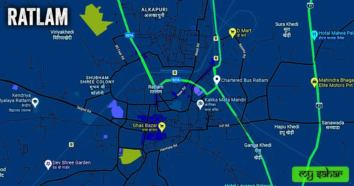
- 80 Feet Road
- Laxman Pura Road
- New Bypass Road
- Karmadi Road
Famous Chowks.
- Maharana Pratap Chouraha
- Fawara Chowk
- Do Batti Chowk
- Station Chowk
- Dil Bahar Chouraha
- Shaheed Chowk
- Hardev Lala Ki Pipli
- Neem Chowk
- Dalu Modi Bazar Square
- Rani Ji Ka Mandir Chowk
- Chandni Chowk
Rivers And Lakes.
- Sajjan Mil Talab
- Amrit Sagar Talab
- Jhali Talab
Ways Of Transportation.

Transportation is an essential element for the development of any city, which connects the city with many other cities and also makes trade easier. The following are the means of transportation here. The major ways of transportation here are roads, rail roots, and airways.
Roads – NH-927A, SH-39A, and NH-156 are the three national and state highways located in this city and connect other cities like – Badnwar, Jaora, Banswara, Mandsaur, and Neemuch together.
Railways – This city has many railway stations but two of them are mainly used called (Ratlam Junction, and New Station). It’s a junction which means it has routes in different directions. its station code is (RTM). its length is about 909.51 meters and its width is 84.41 meters. a total of 165 train runs here.
Airways – This city has some small airstrips but not a proper airport so in any air travel you have to go to its nearest airport which is (Indore Airport) which has so many flights operating here. which is located 136 kilometers away in the east-south direction. it takes almost 2 hours and 35 minutes to reach there.
Pin Code Of City.
people also search on the internet that what is the pin code of this city. The full form of the PIN Code is Postal Index Number Code. And the pin code of the city’s Head Office is – “457001”.
Distance From Major Cities.
- Neemuch – 143km
- Dewas – 140km
- Indore – 137km
- Pratapgarh – 110km
- Ujjain – 103km
- Mandsaur – 89km
- Banswara – 84km
- Badnawar – 45km
- Jaora – 38km
- Namli – 17km
Latest Weather Updates.
The average temperature of this city is around 28°C. The record temperature in summer is 45.5°C and 2.5°C in winter. And here on average 954.0mm (37 inches), every year of precipitation falls. It rains here for about 42 days every year. For today’s weather information in this area, click on the link given below.
- Wunderground
- Weathercity
- Weather-forecast
Watch YouTube Video.
Don’t Want to read watch this video instead and get all of your answers about this city.
News Agencies.
A list of some famous local news agencies is given below. These include newspapers, magazines, local news channels, etc.
- Dainik Bhaskar News
- India MIX News Paper
- News Track News Paper
- Patrika News Paper
- Prasaran Hindi News Paper
- Golden Goonj News Paper Publisher
Best Parks.
- Railway Football Ground
- Polo Ground
- Kalika Mata Park
- Gulab Bagh
- Amrit Sagar Garden
- Katju Nagar Park
- Rotary Garden
- Shantivan Park
- Mahesh Nagar Garden
- Civil Hospital Garden
Best Hospitals.
- Arogyam Hospital
- Ratlam Hospital & Research Center
- CHL Jain Diwarkar Hospital
- Railway Hospital
- Janak Hospital
- Maheswari Hospital
- Bima Hospital
Best Hotels.
- Balaji Central Hotel
- Hotel Samta Sagar Palace
- Hotel Ajanta Palace
- Rudra Palace Hotel
- Hotel Balaji Palace
- Hotel Lavanya Palace
- Hotel Shree Palace
- Hotel Patel Palace
- Sagar Castle Hotel
- Hotel Prince Palace
Best Schools.
- St. Joseph Convent School
- Stanford School
- Podar International School
- School Of Excellence
- Shri Guru Tegh Bahadur Public School
- Kendriya Vidyalaya
- Himalaya Kids
- Morning Star High School
- Auro School
- Delhi Public School
Best Colleges.
- Govt. PG Arts Science Colege
- Royal College City Office
- Shri Arihant College Of Profession Education
- Pranjal Information Technology
- District Homeopathic Medical College
- Shree Sai Institute Of Technology
- Dr. K.N. Low College
- Govt. Girls Degree College
- Shanti Niketan Institute Of Technology
- Govt. ITI College
Geography Of Ratlam.

The area code of this city is (07412) and its height is about (480 meters) above sea level. Here the registration of vehicles is done in “MP-43”. The area of this city is (21.86 km²) and the border is about 24.74 km. There’s a total of “2 Police Station” located in this city.
Official Government Websites.
- Official website of this city – Click here.
- Municipal Corporation’s website – Click here.
- Official Police Website – Click here.
Famous Areas Of City.
- Laxman Pura
- Alkapuri
- Sneh Nagar
- Shastri Nagar
- Ram Bagh
- Palsoda
- Kasturba Nagar
- Komal Nagar
- Karmandi
- P&T Colony
- Jeet Nagar
Famous Places To Visit.
Tourists Attractions –
- Ghas Bajar (Market)
- Babus Water Park
- Anand Big Mall
- Dhan Mandi (Shopping Area)
- Maa Bhagwati Prajapati Complex
- Paryavaran Park
Temples & Mosques –
- Kalika Mata Mandir
- Cactus Garden Of Sailana
- Mahalakshmi Temple
- Mangalay Temple
- Madina Masjid
- Nurani Masjid
- Chingi Pura Masjid
Restaurants, Cafes & Bars –
- Classic Bar & Restaurants
- Indian Coffee Shoppe (Fast Food)
- Cafe Maple
- Swad Restaurant
- Caffeine Hub
- Club 95 (Pub)
- The Two Brothers (Food Truck)
- Checkers Cafe
- Sadda Adda Cafe
- Karu Mama Ki Kachori & Samosa
- Pet Pooja Fast Food
