Motihari | Bihar | Mysahar.in

About Motihari Bihar.
Motihari is one of the popular cities of Bihar for its religious Buddha sites, ancient monuments, small-scale industries, and its delicious cuisine. These tourist places include the famous Gandhi Museum, Gandhi Stambh, Charkha Park, and the famous lake Moti Jheel. Most of the people here are economically dependent on agriculture and mainly grow and sell crops like potatoes, sugarcane, wheat, sweet potato, and cotton. Along with growing these crops, it is also necessary to process them. For which small industries are also located here where sugarcane and paddy are processed. Not only one or two but more than 20 small-scale industries are located here, including Murabba Factory, Suger Mills, Marble Granite Manufacturer, Iron Ispat Manufacturer, Garment Manufacturer, Ply Manufacturing, Brick’s Manufacturing, etc.
The city’s people eat and promote their local food with great enthusiasm. These dishes include Thekua, Dahi Chivda, Sattu Ghol, Aam Jhor, Malpua, Peda, Kala Jamun (Gulab Jamun), Khurma, and the most famous North Indian includes litti chokha. The city is named after two of its ancient kings, “Moti Singh” and “Hari Singh”. In 1971, Champaran was divided into East and West Champaran, when Motihari was also made the headquarters of East Champaran.
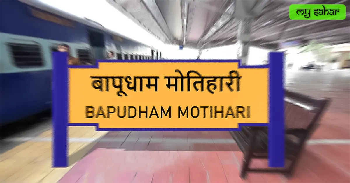
Champaran Satyagraha, Nil Kheti Satyagraha, and Kheda Satyagraha were the three major Satyagraha due to which Mahatma Gandhi came here for the first time and due to this the name of Motihari Railway Station was changed to “Bapudham Motihari Railway Station”. A local cricket player here, Saqibul Gani created a new history by scoring a triple century in a Ranji Trophy cricket match played in 2022. According to the census, about “2 lakh 26 thousand” people used to reside here in 2011, which has increased to more. Here people mainly use Bhojpuri, Hindi, and Urdu languages.
Famous Roads.
- Bettiah Road
- Bhandar Road
- Areraj Road
- Bagaha Dhala Road
- City Main Road
- Balua Chandmari Road
- Sardar Patel Road
- Head Post Office Road
- Station Road
- Bypass Road
- Janpul Road
- Madhubani Ghat Road
- Kachahari Road
- Mahatma Gandhi University Road
- Bariyarpur – Chintana – Kotwa Road
Famous Chowks.
- Gandhi Chowk
- Jaanpul Chowk
- Madhuban Chawni Chowk
- Hospital Chowk
- Arya Samaj Chowk
- Chatauni Chowk
- Satyagraha Chowk
- Dwar Devi Chowk
- Awdhesh Dhowk
- Chandmari Chowk
- Balua Sabji Mandi Chowk
- Kachahari Chowk
- Hawai Adda Chowk
- Rajendra Pratap Singh Statue
- Pipal Chowk
- Town Hall Chowk
Rivers And Lakes.
- Dhanauti River
- Jheel
- Moti Jheel
Ways Of Transportation.

Transportation is an essential element for the development of any city, which connects the city with many other cities and also makes trade more accessible. The following are the means of transportation here. The major ways of transportation here are roads, rail roots, and airways.
Roads – NH-527D and SH-54 are the two National and state highways that pass through this city and connect other neighboring cities like – Betttiah, Chakia, Mohammadpur, and Areraj together.
Railways – The city has two railway stations but one of them is mainly used by people here called (Bapudham Motihari Railway Station). its station code is (BMKI). its length is about 703.56 meters and its width is 59.10 meters. a total of 38 trains runs here every month.
Airways – City doesn’t have any kind of airport so people here have to go to its nearest airport which is (Kushinagar International Airport) which is an international airport. which is located 153 kilometers away in the west direction from here. it takes 3hour and 25minutes to reach there.
Pin Code Of City.
people also search on the internet that what is the pin code of this city. The full form of the PIN Code is Postal Index Number Code. And the pin code of the city’s Head Office is – “845401”.
Distance From Major Cities.
- Areraj – 30km
- Dhaka – 32km
- Chakia – 34km
- Sheohar – 57km
- Saraiya – 77km
- Gopalganj – 84km
- Muzaffarpur – 84km
- Sitamarhi – 89km
- Siwan – 96km
- Chapra – 119km
- Patna – 151km
Latest Weather Updates.
The average temperature of this city is around 24°C. The record temperature in summer is 44°C and 0°C in winter. And here on average 1290mm (50 inches), every year of precipitation falls. It rains here for about 53 days every year. For today’s weather information in this area, click on the link below.
- Weather-forecast.com
- Weathercity.com
- Eldoradoweather.com
- Meteotrend.com
News Agencies.
A list of some famous local news agencies is given below. These include newspapers, magazines, local news channels, etc.
- Border News Mirror
- INS24 News
- Real News
- The Royal News
- Today Bihar News
- Tarang Media
- All India News
Best Parks.
- Satyagra Park
- Charkha Park
- Subhash Park
- Narega Park / W&M Park
- Satyagraha Smarak
- Swami Vivekanand Park
- Ramesh Verma Memorial Park
Best Hospitals.
- Sadar Hospital
- Banarsidas Chandiwala Eye Hospital
- Rajpali Hospital
- District Health Society
- Sai Hospital
- Arohi Multispeciality Hospital
- Sanvi Hospital
- Health Care Hospital
- M.G. Hospital
Best Hotels.
- Ram Bhawan Ram Yamuna Prasad Hotel
- Hotel Rudra Regency
- Hotel Ramsan Plaza
- Hotel S.S. Exotica
- Rajeshwari Palace Hotel
- Hotel Green Park
- Lummj Guest House
- Hotel Simran
- Hotel Sheetal Regency
- Hotel Aditya International
Best Schools.
- C.S. Dav Public School
- Shantiniketan Jubilee School
- Xavier’s High School
- Zila School
- M.S. Memorial Public School
- Modern Public School
- Emmanuel School
- Bethel School
- RK International Public School
- Mujib Girls High School
Best Colleges.
- Laxmi Narayan Dubey College
- Ugam Pandey College
- Sri Narayan Singh College
- MS College
- Mahatma Gandhi Central University
- Motihari College Of Engineering
- Dr. Shri Krishna Sinha Women’s College
- Govt. Polytechnic College
- Indus ITI
- Mangal Seminary Inter College
Geography Of Motihari.

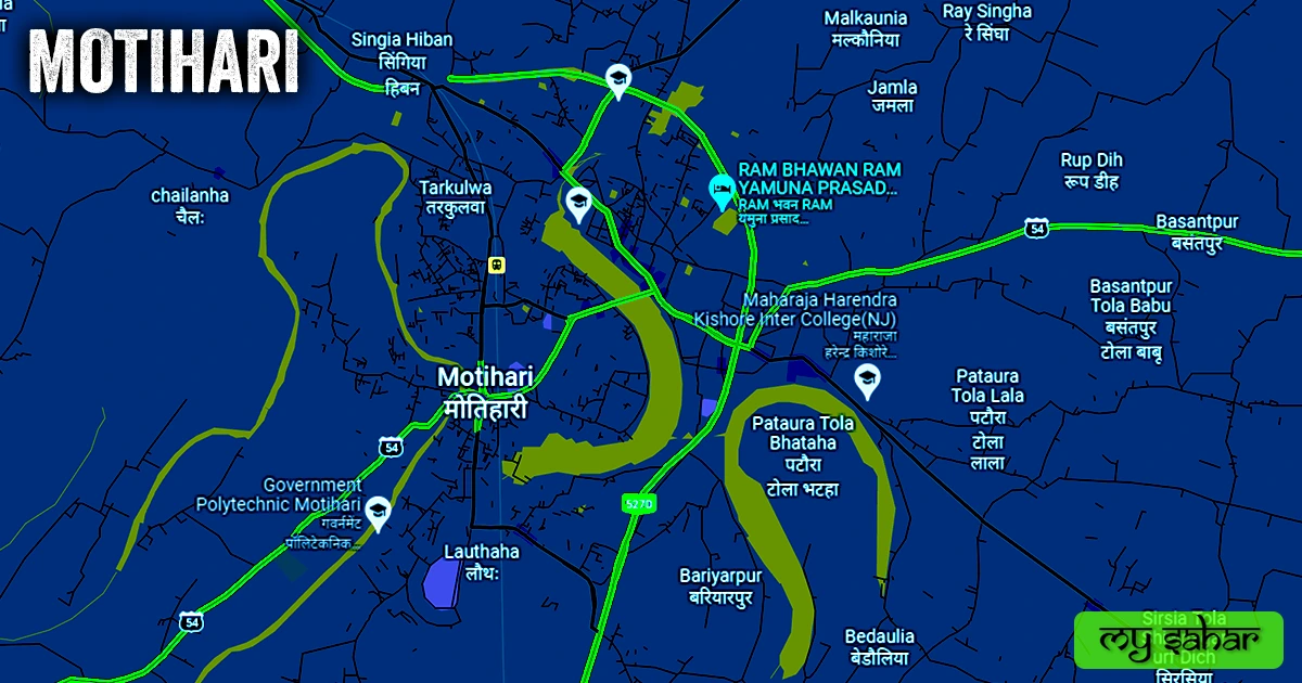
The area code of this city is (06252) and its height is about (62 meters) above sea level. Here the registration of vehicles is done in “BR-05”. The area of this city is (40.74 km²) and the border is about 24.25 km There’s a total of “7 Police Station” located in this city.
Official Government Websites.
- Official website of this city – Click here.
- Municipal Corporation’s website – Click here.
- Official Police Website – Click here.
Famous Areas Of City.
- Rajendra Nagar
- Agarwa
- Mathiya Dih
- Pataura Tola
- Ekauna Part
- Belbanwa
- Tarkulwa
- Henary Bazar
- Kolhuarwa
- Banjaria
- Arya Nagar
- Gandhi Nagar
- Raghunathpur
- Lauthaha
- Pipra
- Bariyarpur
Famous Places To Visit.
Tourist Attractions –
- V-Bazar
- Gandhi Museum And Auditorium
- V-Mart
- W&M Fashion
- Mina Bazar
- Jalgaon Water Park
- Gandhi Stambh
- Satyagraha Smarak
- Citykart
- Moti Jheel
- Mega Value Shopping Mall
- Classy Fashion Mall
- Charkha Park
Movie Theaters –
- Mahadev Talkies
- Sangeet Cinema
- Sanjay Cineplex
- King Scale Theatre
- Payal Cinema
Temples & Mosques –
- Shri Durga Mandir
- Gayatri Mandir
- Agarwa Jama Masjid
- Sapahi Devi Mandir
- Makki Masjid Balua Tal
- Belhi Devi Temple
- Arya Samaj Mandir
- Masjid-E-Belal
- Bnjriya Masjid
- Meena Bazar Masjid
Restaurants & Cafes –
- Jaiswal Hotel
- The Annapurna Restaurants
- Rasoi Mahal
- D’Das Point
- New Sai Sweets and Restaurants
- Yummy Foods
- The City Cafes