Kanpur | Uttar Pradesh | Mysahar.in

About Kanpur Uttar Pradesh.
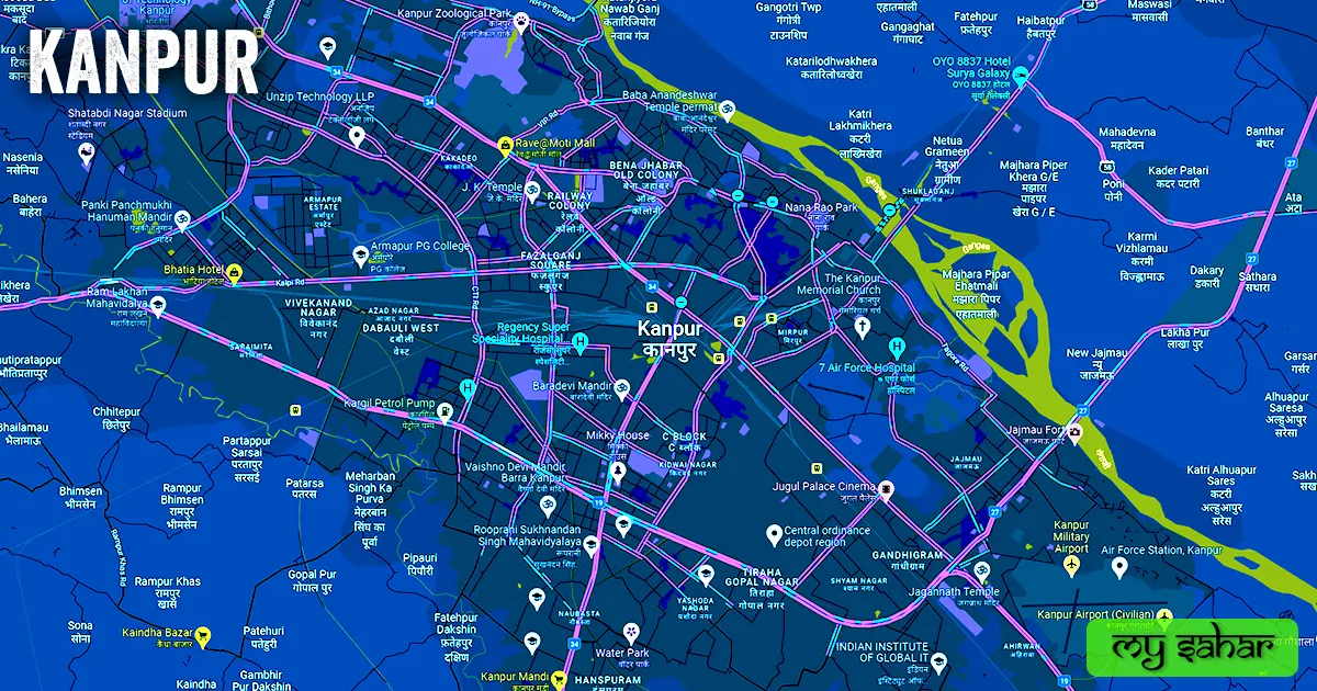
In the Uttar Pradesh State, 90km far from Lucknow the smart city of Kanpur is located. It is known across the world for its businesses, industry (particularly leather manufacturers), colonial buildings, green spaces, and delicious food. “The industrial capital of Uttar Pradesh” is also another name for Kanpur. because the majority of the state’s manufacturers and industries are located in this city.
Considering the 19th-century beginning of the leather industry Only this particular sector does more than “two thousand crores” in business annually. In addition to being produced in large quantities, leather goods, including shoes, harnesses, wallets, belts, and purses, are also shipped for sale from Kanpur to other western nations and states.
This has resulted in the employment of approximately 2.5 lakh people. This is the reason that many laborers from other states come here in quest of employment. There are more than 400 of these factories in Kanpur. Wheat, barley, sorghum, sugarcane, potatoes, and gram are among the crops that are farmed around this city. Along with this, several types of mango and mahua crops are also produced there.
Imarti, Kheer, Biryani, Sultani Dal, Milk Shakes, and Shami Kebab are among Kanpur’s favorite foods. “Raja Hindu Singh” of the Sachendi State built Kanpur in 1803. Kanhapur was the name given to it historically. There are air routes (Ganesh Shankar Vidyarthi Airport) and railroads (rail junctions) accessible here in terms of modes of transportation. About 45 lakh 81 thousand people live in Kanpur, according to the population count. and mostly speak in Hindi and Urdu.
Famous Roads.
- Unnao Road
- Raebreli Road
- GT / Allahabad Highway
- Hamirpur Road
- Etawah Highway
- Hardoi / Aligarh Road
- Kalpi Road
- Kalyanpur / Vijaynagar Road
- Mall Road
- Parwati Bagla Road
- Vip Road
- Halsi Road
- Canal Road
- Ghantaghar Flyover
- Cambridge Road
- Havelock Lane
- Shuklaganj Bridge
Famous Chowks.
- Afim Kothi Chouraha
- Deputy Padav Chouraha
- Bans Mandi Chouraha
- Mulganj Chouraha
- Parade Chouraha
- Bada Chouraha
- Arya Nagar Chouraha
- Gol Chouraha
- Gurudev Chouraha
- Company Bagh Chouraha
- Tafco Crossing
- Rambagh Chouraha
- Brahm Nagar Chouraha
- Narona Chauraha
- Fajalganj Chauraha
- Galla Mandi Chauraha
- Hanuman Chowk
- Chhapeda Chouraha
- Deoki Chouraha
- Chain Factory Chauraha
Rivers And Lakes.
- Ganga River
- Fly Ash Pond
- Moti Lake
- City Zoo Lake
- Jhakarkati Lake
- Diggi Pond
- Canal
- Sher Shah Suri Tank
- Turtles Pond
Ways Of Transportation.

Any city’s progress relies on its capacity to travel, which links it to numerous other towns in the state and facilitates trade. The available modes of transportation are as follows: Here, airplanes, rail lines, and roadways make up the three main modes of transportation. Some of the main transportation methods in Kanpur are given below.
Roads – The three national roads that travel through this area are NH-27, NH-34, and NH-19, and they interconnect this city with cities such as Lucknow, Jahanabad, Ghatampur, Pukhrayan, Unnao, Bilhaur, and Fatehpur.
Railways – There are several train stations located in Kanpur city. Nonetheless, there are three primary stations (Kanpur Central, Anwargank Station, and Govindpuri Junction). Its primary stations’ station identification code is (CNB). The city’s center is where this station is located. Its width is around 133.55 meters, and its length is approximately 792.89 meters. There are 10 active platforms and a total of 175 trains running through Kanpur Central Station.
Airways – There is an airport in this city that is (Kanpur Airport). It is 14 kilometers from the city center and is located in the southeast. The travel time is close to 29 minutes. Moreover, as this is an airport for domestic travel, there are no foreign flights available from here.
Pin Code Of City.
Google searches by people for Kanpur’s pin code are also common. Postal Index Number Code is the complete name of a pin code. And “208001” is the pin code for the city’s administrative center.
Distance From Major Cities.
- Unnao – 18 km
- Lucknow – 73 km
- Banda – 107 km
- Farrukhabad – 130 km
- Etawah – 134 km
- Shahjahanpur – 165 km
- Prayagraj – 188 km
- Firozabad – 206 km
- Jhansi – 208 km
- Satna – 213 km
Latest Weather Updates.
Its average maximum yearly temperature is 31.9°C, and its typical lowest is 18.8°C. Additionally, it receives 25.52 inches (648.5 millimeters) of rain annually on average. For information on the Kanpur’s weather today, click on one of the links below.
- Weather.ournet.in
- Tomorrow.io
- Meteoin.ru
News Agencies.
The list of notable local news organizations is shown below. These include periodicals, local news channels, newspapers, and magazines.
- Amar Ujala
- Jagran English
- Samay Tak
- News UP – 78
- K News India
- U News UP
- Jan Samna
- Saswat News
- DD Live News
Best Parks.
- Kargil Park
- Phool Bagh Park
- Nana Rao Park
- Triangle Park
- Mikky House
- Sanjay Van Chetana Park
- Eco Park
- Kamla Nehru Park
- Muhammad Ali Park
- Nakshatra Vatika Park
Best Hospitals.
- Regency Hospital
- The Panacea Hospital
- Mariampur Hospital
- Regency Hospital, Govind Nagar
- Kulwanti Hospitals
- Priya Hospital
- Krishna Super Speciality Hospital
- K P M Hospital
- Dey’s Hospital
- Kannika Hospital
Best Hotels.
- The Landmark Towers
- The Bridge Hotel
- Grand Geet Hotels
- Hotel Raja Seth
- Citi Club – Luxury Budget Hotel
- Hotel Krishna Galaxy
- Kingston Resort
- The Meera Hotel
- Hotel Mandakini
- The Gagan Plaza Hotel
Best Schools.
- DPS Azaad Nagar
- Mercy Memorial School
- Methodist High School
- St. Thomas School
- The Jain International School
- Mother Teresa Mission School
- Gardenia Public School
- Jugal Devi Saraswati Vidya Mandir
- Kanyakubja Public School
- Mariampur Sr. Sec. School
Best Colleges.
- Christ Church College
- Axis Colleges
- Dayanand Anglo-Vedic College
- Dr. Virendra Swarup Institute
- Jagran College
- MG College
- Blossom Buds Inter College
- Vikramajit Singh Sanatan Dharma College
- Brahmanand College
- Naraina College
Geography Of Kanpur.

The area code of Kanpur is (0512). about 126 meters above sea level, indicating its elevation. Vehicle registration is carried out in “UP-78” here. This city has a 242.7 km2 area, and its boundaries are 83.72 km long. This offers easy access to a total of “19 police stations”.
Official Government Websites.
- Official website of Kanpur – Click here.
- Municipal Corporation’s website – Click here.
- Official Police Website – Click here.
Famous Areas Of City.
- Sadar Bazar
- Rail Bazar
- Kakadeo
- Keshavpuram
- Swaroop Nagar
- Kidwai Nagar
- Fazalganj
- Azad Nagar
- Shyam Nagar
- Kaushalpuri
- Om Nagar
- Shastri Nagar
- Gwai
- Heera Ganj
- Transport Nagar
- Harris Ganj
- Ghasiyari Mandi
- Jajmau
- Ram Puram
Famous Places To Visit.
Tourist Attractions –
- Somdutt Plaza
- Pakchee Vihar Zoo
- Museum Library
- Pappu Samose Waley
- Nana Rao Park
- Massacre Ghat
- Phool Bagh Park
- Mikky House
- Jungle Water World
- Blue World Theme Park
- Zoological Park
- Dream World Resort
Shopping Malls –
- Z Square Mall
- Rave 3 Mall
- Ganges Mall
- Rave@Moti Mal
Temples & Mosques –
- J. K. Temple
- Tapeshwari Devi Mandir
- Anandeshwar Temple
- Baradevi Mandir
- ISKCON Temple
- Vaishno Devi Mandir Barra
Restaurants & Cafes –
- TreeHouse (Cafe)
- Mocha Cafe
- Offline Cafe
- D-Cafe