Deoria | Uttar Pradesh | Mysahar.in

About Deoria Uttar Pradesh.
Deoria is located 35km away from Kushinagar City in the state of eastern Uttar Pradesh. Which is known for its agriculture and allied industries. Rice, pulses, and sugarcane are mainly cultivated here. In which sugarcane is cultivated in large quantities. Uttar Pradesh is the largest producer of sugarcane in India. that every year Produces “13 crores 50 lakh tonnes” of sugarcane, in which Deoria also has a big hand.
This is the reason that there are 5 to 6 big sugar processing factories located in Deoria. Where they are cleaned and processed to make sugar, jaggery, and other food items. Which is later exported to other states by roads and trains. Before 16 March 1946, Deoria used to be a part of the Gorakhpur district which was separated later. There is also a lot of confusion regarding the origin of its name.
Deoria’s earlier name Devpuria was changed later. Some argument says that its name has been taken from the Ashram called Devraha Baba Ashram situated in this city. According to the census, about “1 lakh 29 thousand” people live here. It has a sex ratio of 920 females for every 1000 males. People of Deoria use Hindi, Bhojpuri, Urdu, and English languages in their everyday life.
Famous Roads.
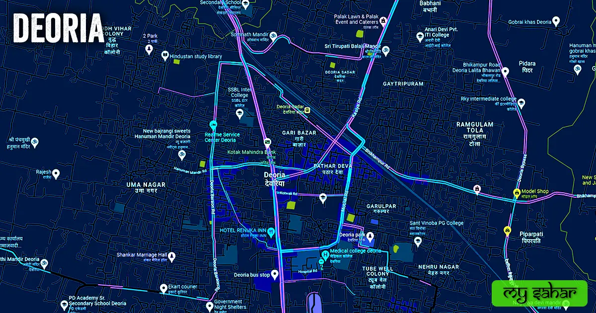
- Gorakhpur Road
- Kushinagar Road
- Kasia Road
- Salempur Road
- Barhaj Road
- Bhikhampur Road
- Motilal Road
- Kasia Bypass Road
- Station Road
- Baraon Road
- Hanuman Mandir Road
- Malviya Road
- Bypass Road
- Baikunthpur Road
- Ramlaxan Road
- Beldar Road
- Saket Nagar Road
Famous Chowks.
- Amarjoti Chowk
- Bhajuli Chowk
- Bhatwaliya Chouraha
- Chakiya Chouraha
Rivers And Lakes.
- Kurna Nahar
- Jalkal Talab
- Hanuman Mandir Pokhra
- Baba Raghav Das Pokhra
- Dried Lake
Ways Of Transportation.

Transportation is an essential element for the development of any city, which connects the city with many other cities and also makes trade more accessible. The following are the means of transportation in Deoria. The major ways of transportation here are roads, rail roots, and airways.
Roads – The SH-01 and SH-79 are two state highways that run through this city, which connect Deoria to other neighboring cities like – Gorakhpur, Selempur, Rudrapur, Baikunthpur, and Mail Bazar together.
Railways – This city has a station called (Deoria Sadar). Its station code is (DEOS). this station is located in the north of the town Its length is about 796.72 meters and the width is about 41.73 meters. a total of 106 trains are active here and it has a total of 3 platforms in operation.
Airways – Deoria doesn’t have its own airport. so if people want any domestic and international flights they have to go to its nearest airport known (Kushinagar International Airport). which is located 37.1 km far away in the north direction here. it takes nearly 1 hour to reach there.
Pin Code Of City.
Often people also search on Google what is the pin code of Deoria city. The full form of a Pin Code is Postal Index Number Code. And the pin code of the city’s head office is – “274001”.
Distance From Major Cities.
- Gorakhpur – 49 km
- Mau – 66 km
- Ara – 136 km
- Varanasi – 151 km
- Patna – 167 km
- Muzaffarpur – 167 km
- Mirzapur – 192 km
- Kathmandu – 204 km
- Darbhanga – 214 km
- Prayagraj – 225 km
Latest Weather Updates.
Deoria’s maximum annual temperature is around 37.7 °C and the minimum is around 9.4 °C. And it receives an average of 876 millimeters (33.36 in) of rainfall every year. To get today’s weather information in this town, click on the link given below.
- Timeanddate.com
- Theweathernetwork.com
- Weathercrave.com
News Agencies.
A list of some famous local news agencies of Deoria is given below. These include newspapers, magazines, local news channels, etc.
- Indian Express-News
- Live Hindustan
- Nyay Sakshi
- City Times
- HS Live News
- APN Live
- Blackout News
- ISD News
- MM India News
- News Sabaki Pasand
Best Parks.
- City Park
- Pt. Deen Dayal Park
- Post Office Garden
- Town Hall Park
- Ghura baba bageecha
- Ambedkar Park
- Atal Bihari Bajpai Park
- Bashir Ahamad Park
- Peaceful garden
- Chhota Park
Best Hospitals.
- Savitri Hospital
- Global Hospital
- Shanti Hospital
- Heart Care Center
- Sadar Hospital
- Abeda Hospital and research center
- Dr. Singh ENT Hospital
- Star Hospital
- Mahadewa Hospital
- District Hospital
Best Hotels.
- Golden Laurel Innternational
- Baby & moms
- Ashoka Hotel
- Hotel Shivaya
- Hotel Heaven
- Hotel Crown Innternational
- Sahara Palace
- Rajshree Innternational
- Hotel Shivaya
- Hotel Golden Tulip International
Best Schools.
- Senior Secondary School
- Jeevan Marg Sophia Secondary School
- D.M.T. Public School
- P.D. Academy Sr.Secondary School
- Holy Angels Public School
- Chandra Public School
- P.N. Academy
- Agrawal Public School
- Scholar’s Senior Secondary School
- public school
Best Colleges.
- Government Intermediate College
- Degree college
- Maharaja Agrasen Boys Inter College
- Anari Devi Pvt. I.T.I. College
- Sant Vinoba P. G. College
- Deen Dayal Upadhyaya Girl’s P.G. College
- Government Polytechnic College
- RKY intermediate college
- Physics Department, B.R.D. P.G.College
- Baba Raghav Das Inter College
Geography Of Deoria.

The area code of Deoria is – 05568. Its height is about 68 meters above sea level. Here the registration of vehicles is done in “UP-52”. The area of Deoria city is (14.82 km²) and the border is about 17.75 km. There is a total of “4 Police Stations” situated in this city.
Official Government Websites.
- Official website of Deoria – Click here.
- Municipal Corporation’s website – Click here.
- Official Police Website – Click here.
Famous Areas Of City.
- Nai Bazar
- Gayatri Puram
- Budhbihar Colony
- Gari Bazar
- Ramgulam Tola
- Pathar Deva
- Raghav Nagar
- Saket Nagar
- Uma Nagar
- Bhatwaliya
- Nehru NagarNath Nagar
- Swami Vivekanand Colony
- Tubewell Colony
Famous Places To Visit.
- Just Chill Water Park
- S S Mall
- Devarahi Mandir
- T Street Cafe
- Neffex (Museum of zoology)
- Hanuman Mandir
- Food Junction
- De’oriens Cafe & Dine
- City Park
- Somnath Mandir
- Cafe Blessings
- City Kart
- Pt. Deen Dayal Park
- Chit Chat Resturant
- Shri Tirupati balaji Mandir
- Kedia Plaza
- Hashtag Cafe & Lounge