Discovery of Bihar Sharif | Mysahar.in

About Bihar Sharif Bihar.
In the center of Bihar lies a historic city called Bihar Sharif. This city is home to Bihar’s oldest historical landmark, Nalanda Mahavihara, as well as several other world-heritage sites, small businesses, and historical graves. This town, which is about 70 kilometers from the state capital of Patna, is where large-scale mustard, sugarcane, potato, wheat, and rice agriculture is done. These crops rank second in the state in terms of crop output, and they provide a source of income for the locals. These crops are not only grown but are also sold to other states.
Along with the numerous minor domestic businesses in this city, there are over 20 other domestic industries, and workers from other cities travel to work in these industries as well. Among these are the manufacturing of pipes, elephant soap, milky queen ice cream, agarbatti, animal feed and mustard oil, battery acid, and agarbatti factories. This area is also known as “Mini Surat” since it is home to sizable textile markets. The two primary sources of income in this region are manufacturing and tourism. However, this Manibaba Akhara hosts the yearly “Chirga” and yearly “Langot Mela” as forms of amusement.
Because the remains of the world’s first residential university, Nalanda, and the Buddhist teaching institution, Odantapuri, are here, a lot of tourists come here every year. UNESCO has designated Nalanda as one of its World Heritage Sites. It was constructed in the fifth century BC by the Pala dynasty. Around the 11th and 12th centuries, it was pillaged and destroyed by the Muslim conqueror Ikhtiyar al-Din Muhammad Bakhtiyar Khalji. The Xuan Zang Memorial Hall and the many shrines and graves of Muslim monarchs are two other tourist attractions. The terms “vihar” and “sharif” combine to form the city’s name. According to the 2011 Census, the city has a population of two lakh nineteen thousand people. Maghi, Hindi, and Urdu are the primary languages used.
Famous Roads.
- Barbigha / Mokama Road
- Bypass Road
- Nawada Road
- Rajgir Road
- Pahadi Bypass Road
- Sohsarai-Khasganj Road (Ranchi Road)
- Kisan College Road
- Badi Pahadi Road
- Pahartali Road
- Nijay Road
- Naisarai / Azizghat Main Road
- Mahal Par Road
- Chowk Bazar Road
- Railway Station Road
- Nala Road
Famous Chowks.
- Ambedkar Chowk
- Kargil Chowk
- Shivaji Nagar Chowk
- Sakunat More
- Khandak More
- Naisarai Chouraha
- Kachahari Chouraha
- Sohsarai Chouraha
- Nalanda College More
- Daira More
Rivers And Lakes.
- Panchane River
- Akhara Par Talab
- Adarsh School Talab
- Boating Pond (D.M. Colony)
- Paila Pokhar
- Singarhat Pahartali Lake
- Pakki Lake
Ways Of Transportation.

Any city’s growth depends heavily on its transportation system, which links it to numerous other cities and facilitates trade. The available modes of transportation are as follows: Roads, rail lines, and airways make up the main modes of transportation in this area.
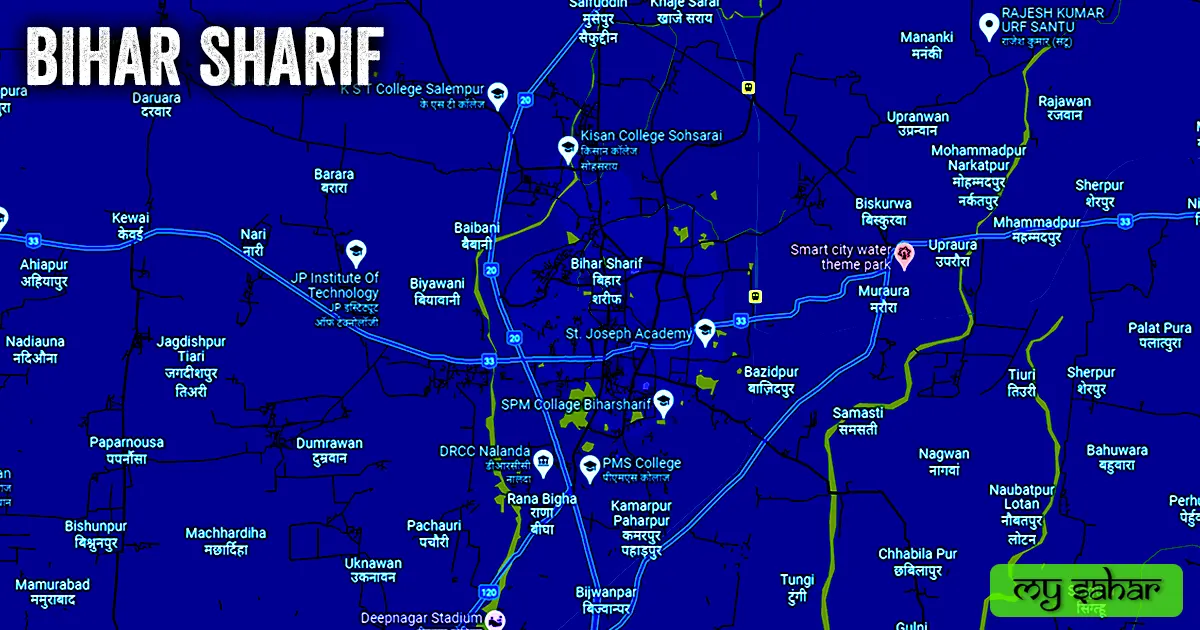
Roads – Three national roads, NH-33, NH-20, and SH-120, connect this city to other sizable adjacent towns, including Jahanabad, Barbigha, Baktiarpur, Nawada, Rajgir, and Gaya.
Railways – In this city, there is a train station named (Bihar Sharif Junction). As a junction, this station has trains running in multiple directions. The station’s code is (BEHS). Its width is 62.24 meters, and its length is approximately 789.41 meters. A total of 12 trains operate from this station.
Airways – There isn’t a functioning, operational airport in this town. Therefore, everyone traveling by air must fly to the airport that is closest to them, which is (Jayprakash Narayan Airport). The distance from here to this airport is 75 kilometers in an east-south direction. To get there, it takes around 1 hour and 53 minutes.
Pin Code Of City.
People also look for the pin code of this city on the internet. Postal Index Number Code is the full name of the PIN code. And “852201” is the pin code for the city’s administration center.
Distance From Major Cities.
- Rajgir – 26km
- Barbigha – 27km
- Ekangarsarai – 32km
- Nawada – 40km
- Jahanabad – 59km
- Patna – 70km
- Gaya – 78km
- Begusarai – 87km
- Arrah – 114km
- Munger – 137km
Latest Weather Updates.
This city’s typical temperature is approximately 35°C. 38°C is the summer record, and 10°C is the winter record. And the annual average rainfall in this area is 885.6 mm (34 inches). Here, it rains for roughly 77 days a year. Click the link below to get the local weather for today.
- Ventusky.com
- Weatherlabs.in
- Freemeteo.in
- Climate-data.org
News Agencies.
A list of some famous local news agencies is given below. These include newspapers, magazines, local news channels, etc.
- News Today Media
- Sheikh Pura News
- Bihari 24
- Idea Citi News Network
Best Parks.
- Subhash Park
- Kargil Park
- Badi Pahadi Park
- Raibahadur Babu Edal Singh Park
- Children Park
Best Hospitals.
- Jeevan Jyoti Superspeciality Hospital
- Shishu Kendra
- Sadar Hospital
- Basu Surgical & Urology Hospital (Dr. Balmukund)
- Nalanda ENT Clinic (Dr. Arun Kumar)
- Matritva Chhaya hospital
Best Hotels.
- Hotel Gurukripa INN Banquet Hall
- Hotel Sunrise
- Ajanta Hotel & Restaurant
- Hotel Mayur Palace
- Hotel Amulya Inn
- Hotel B.M. Palace
- Online Hotel
- Hotel Manish Palace
- Hotel Aditya
- Hotel Mount View
Best Schools.
- RPS School, Golapur
- St. Joseph Academy
- Cambridge School
- Sadar Alam Memorial Secondary School
- Lal Class Concept School
- Rosemary Land School
- SP Arya Dav Public School
- Daffodil Public School
- Asha Memorial School
- SS Balika School
Best Colleges.
- Nalalnda College Bihar Sarif
- SPM College
- KST College Salempur
- Allama Iqbal College
- Soghra College
- J.P. Institute Of Technology
- PMS College
- Kisan College Soharai
- Deo Sharan Womens Evening College
- Nalanda Shodh Sansthan & College
Geography Of Bihar Sharif.

This city has an area code of (+916112) and is situated around 55 meters above sea level. Vehicle registration is carried out at “BR-21” in this location. This city has a (15.20 km²) square area, and the boundary is around 28.86 km long. This city contains a total of “8 Police Stations”.
Official Government Websites.
- Official website of this city – Click here.
- Municipal Corporation’s website – Click here.
- Official Police Website – Click here.
Famous Areas Of City.
- Sherpur
- Mohalla Kantahi
- Udantpuri Colony
- Takiya Per
- Azizghat
- Sohsarai
- Bhaisasur
- Sakunat Kala
- Saluganj Mohala
- Patel Nagar
- Bari Pahadi
- Habibpura
- Khandak Par
- Khanqah
Famous Places To Visit.
Temples & Mosques –
- Sant Baba Temple
- Baignabad Badi Mosque
- Hanuman Mandir
- Maa Vaishno Dham
- Noor Masjid
- Devisthan Temple
- Shiv Nabdir, Garhpar
- Salempur Masjid
- Sakunat Kurd Mosque
- Murtaza Aran Mosque
Restaurants & Cafes –
- New City Family Restaurants
- Rajdarbar Restaurant
- Momo Nation Cafe
- Blue Dimond Restaurants
- Cafe Divine Restaurant
- Orchid Restaurant
- Elite Family Restaurants
Tourist Attractions –
- Ruins of Nalanda University
- Nalanda Museum
- Nageshwar Mall & Multiplex
- City Kart Stores
- Maghra Commercial Complex
- Gangotri Complex
- Smart City Water Theme Park
Movie Theaters –
- Kisan Cinema Hall
- Ajanta Cinema Hall
- Vandana Cinema
- Kumar Cinema Hall